Chi tiết tin - Quảng Bình (Tiếng Anh)
Minh Hoa district
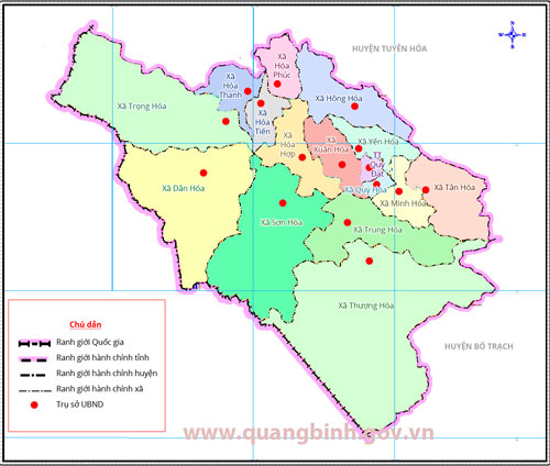
MINH HOA ADMINISTRATIVE MAP
Minh Hoa is endowed with many advantages and potentials. The district has the Cha Lo - Na Nhau International Border and many major roads, including the Ho Chi Minh Road and the National Road No.12A stretching from Thailand through Laos to the National Road No.1A and to Hon La Seaport. Minh Hoa is also home to many historical relics and many beautiful natural sceneries, suitable for the development of tourism. The district can also boost trade with other provinces and other countries in the region.
ADMINISTRATIVE UNITS DIRECTLY UNDER THE DISTRICT
|
Minh Hoa statistical yearbook 2011


